Tuesday, February 28, 2006

The Weathered Cliffs of Bopec

This photo was supposed to be part of the post below this one, but the internet seems to have swallowed it up, so I'll put it here.

During the last few weeks, I've taken quite a few photos from the cliffs pictured here, which are located at the top of the ridge above Bopec.

I'll be posting some more of them in the days to come.

The south end of Bonaire is pretty flat, but the terrain up north is the exact opposite. There are many large and small hills, and it is quite educational to observe the same general area from a variety of vantage points. It is hard to make sense of it all from any one spot.

Monday, February 27, 2006

Mondi Stomping

We revisited some of my old stomping grounds of exactly thirty years ago this past Sunday afternoon. I first came to Bonaire in 1975, and by 1976 I was exploring the meandering dirt roads of Slagbaai on a little Honda 90 motorbike, enjoying really dark sky satellite viewing sessions by the as-yet-unrestored buildings on the beach, climbing the back side of Brandaris, and even had a campout or two at Wayaka. (not to mention getting a VW Beetle way stuck in the "dry" Salt flats between Slagbaai and Wayaka.) We'd borrow the key to the gate located between Goto Meer and Dos Pos and zoom right in. (That gate and road is still in use. We last traversed it about six years ago when our son, Richard's, HAVO class had an class camping trip at Slagbaai.)

I had somewhat mixed feelings when Slagbaai was incorporated into Washington-Slagbaai National Park in 1979. I was glad that the area would be preserved in it's natural state, but knew I would miss the relatively direct access to its beauty. I was definitely pleased when a new dirt road was put in, passing through some of the most scenic areas. I had graduated from the little Honda 90 to a Myers Manx dune buggy by then and we loved our regular park excursions.

Unfortunately, that road only lasted a few years before the hilly parts were destroyed by erosion. That part of the park has been pretty much inaccessible for a couple decades now. I'm still hoping that that road will someday be rebuilt, with cement on the hills, like some of the other park roads. It would mean a lot more area for the rangers to patrol, but it is such a unique part of the park, that no one gets to see. Maybe that loop could be opened just on certain days of the week, to keep the management of it from getting to be too much work.

I revisited some of the old roads by bicycle, back in the mid 80's, when I got my first primitive mountain bike, pedaling in on the old path from the ridge above Bopec. Even back then, there were areas that were so overgrown that I had to carry the bike on my shoulder as I pushed through the bushes encroaching on the old paths.

These days, most of those old roads have just about completely disappeared, even when you know exactly where to look for the remaining traces of them. In one sense, that's ok because it shows that the island capable of healing itself, but for me those ancient tracks represent part of the history of Bonaire.

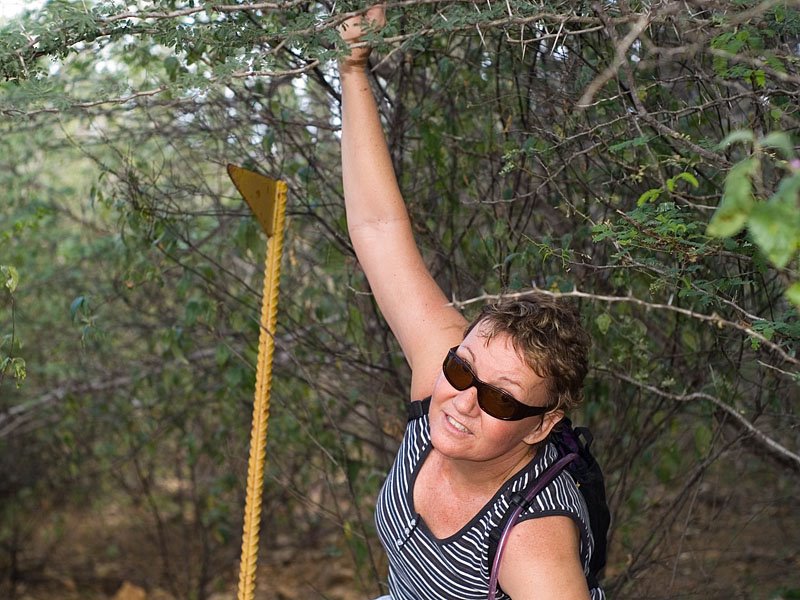
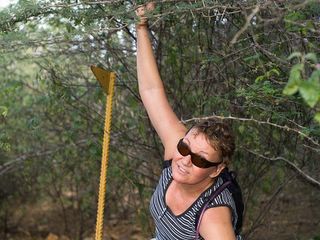
Regular visitors to Washington Park will probably recognize the triangular sign post in this photo. You can still see them here and there indicating the direction of a main park route. This lonely one reminds me of the lamp post in "the Lion the Witch and the Wardrobe" because it looks totally out of place in what is now an overgrown, almost impenetrable thicket. Sandra had to hold back the branches so I could get a clear shot of it.


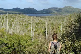
We had just about become convinced that the old road was lost forever, when we came across this proof that we were on the right track after all. Our handy-dandy GPS receiver made sure that we could retrace our steps back to civilization. That, and looking for our footprints in the dust, the direction of the constant trade wind, and location of the afternoon sun. It's pretty hard to get really lost on Bonaire, especially if you've pretty much memorized the topo maps of the area. But a little bit lost is pretty normal, since you can be less than 10 meters from the path and not be able to discern it at all.

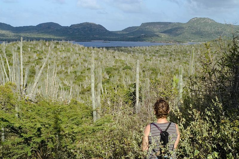
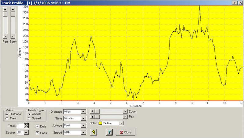
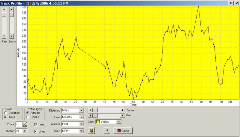
We actually didn't cover very much ground Sunday because of the slow going in the thorn infested overgrown terrain. But we climbed the hill we wanted to climb, observed the lay of the land from a different perspective, and I can now load one more track onto my newly computerized map of the area.

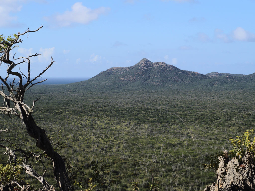
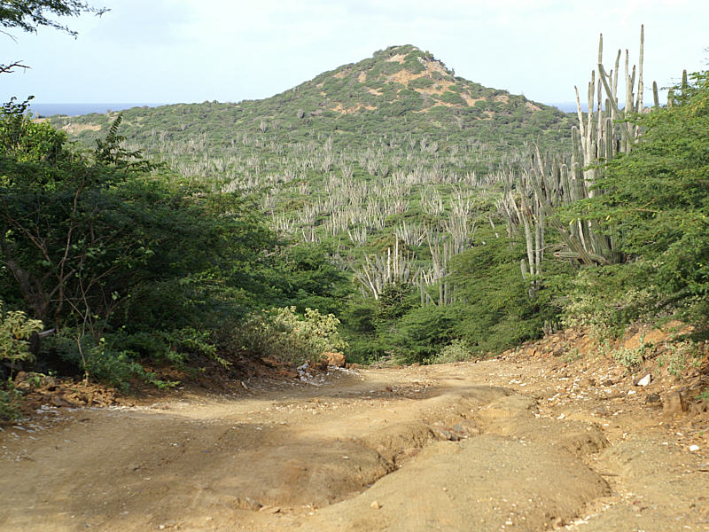
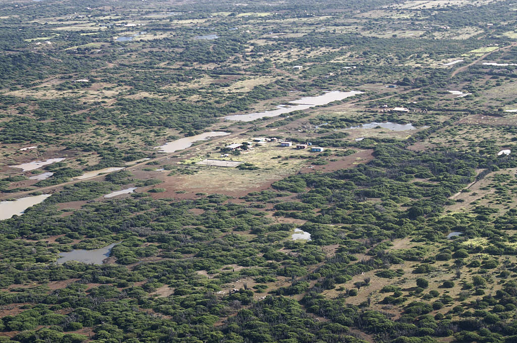
I think the Slagbaai/Goto Meer valley area between the rugged hills of Washington and the cliffs and hills along the coast is one of the most beautiful parts of Bonaire.
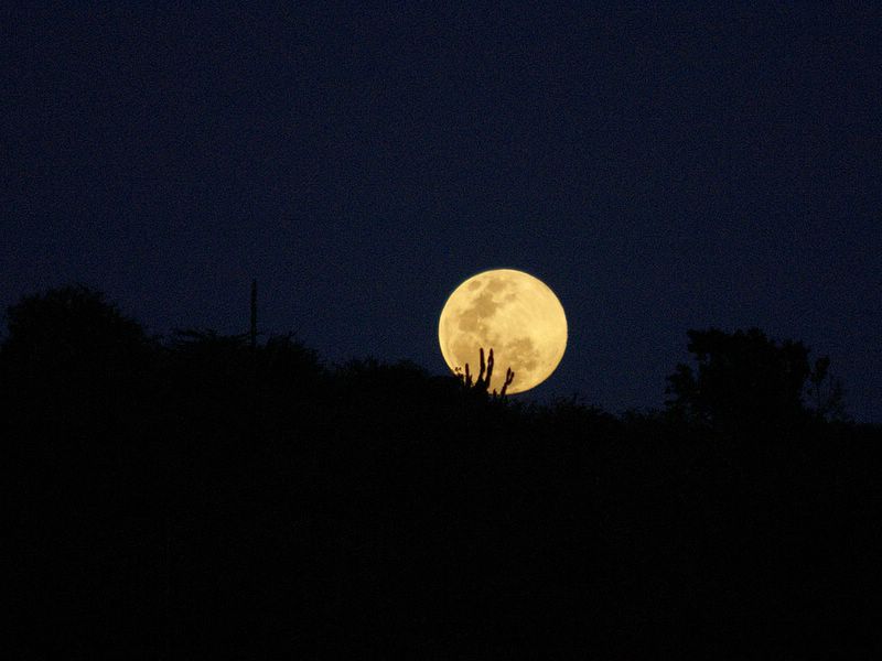
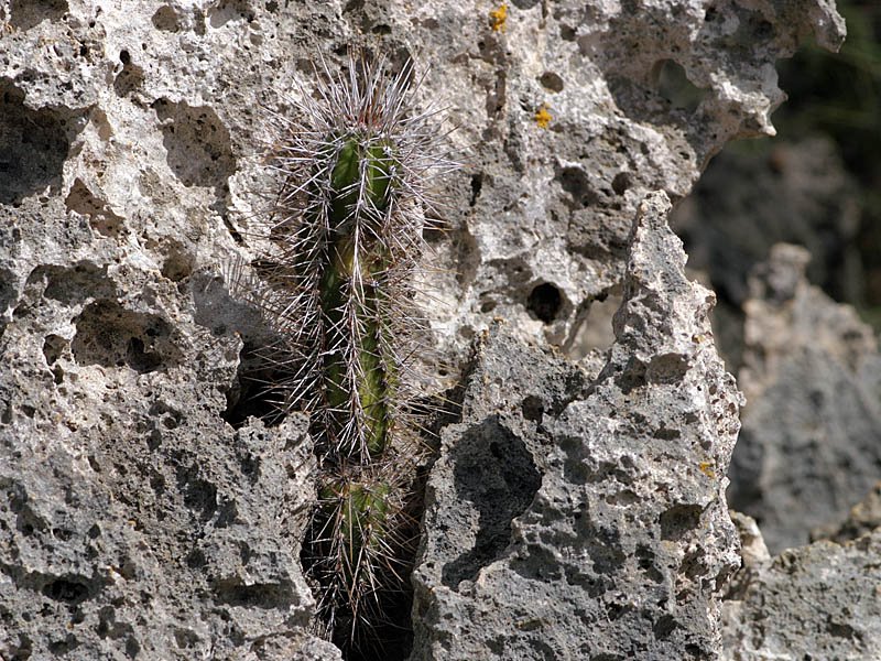
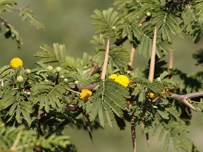
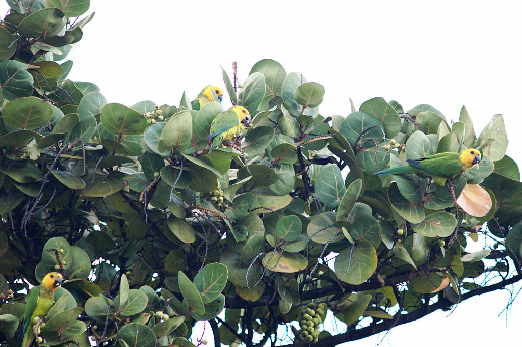
 Posted by Picasa

Carnival Monday

So today is Carnival Monday, a national holiday so people can recover from the excesses of the weekend. Remember the movie, Bedazzled, where Eliot first visits the club dV8. He thinks it represents exactly what he wants. Then towards the end of the movie, a somewhat wiser Eliot visits the club again, and we get an entirely different perspective on things.

Colorful floats and shiny costumes don't do much for me any more, 'cause I've seen too much permanent fallout from this relatively short lived annual escape from common sense and responsibility. I can still visualize seeing a Bonairian friend sneaking off with a woman, not-his-wife, something he would never have done under normal circumstances

Unfortunately, this year was no exception. As much as I hate to miss a day of cycling here on Bonaire, I never ride during Carnival season. I've witnessed enough craziness over the years to realize that it's just not safe to be out on the road, "protected" only by a thin layer of spandex and a Styrofoam helmet. The fresh set of skid marks we saw yesterday heading straight off the road at the corner by the Hilltop Hotel only served to reinforce that notion.

I'm also saddened to report that our good friend Amado Felix's aunt was killed instantly Saturday, right by Cultimara, when she was hit by a youth on a speeding motorcycle. Then that night, another friend, Wai Man Chan, had his restaurant, China Nobo, trashed by a crazed man on a rampage.

So I think my cynical attitude is here to stay and I probably won't be posting any colorful Carnival photos, ever.

Wedding Bells


I recently mentioned that our son, Richard, and his long time girlfriend, Nancy, will be getting married this summer. Here is a recent picture of the happy couple.

Tuesday, February 21, 2006

More Flamingos

I had a full memory card in my camera by the time I got to Goto Meer on Sunday. Some flamingos were in close, so I started deleting images (of Brandaris, heh-heh) and snapping away.

The flamingos were spending a lot of time feeding with their heads under the water. That's the only time I moved.

This one was doing sentry duty.


Here are a couple flamingos having their version of a bad hair day.


Freddy flamingo strikes a classic pose. Posted by Picasa

Monday, February 20, 2006

Seru Bentana


Once you know that a seru is a hill and that a bentana is a window, you'll know Seru Bentana when you see it.

I stopped to get a GPS reading at the survey marker by the lighthouse last week when we were doing one of our group bike rides in Washington Park. There are survey markers all over the island, but only a few are plotted on the topo maps. Map page one has three, Seru Wekua, Seru Bentana, and Brandaris. We climbed Brandaris about a month ago, but I forgot to get a GPS fix, so I'll be using the other two markers to calibrate my map when I scan it into the computer.

If you tell the software the location of a couple of points on the map, it can figure out the location of all the rest of the points on the map.

By the way, the cool topo maps of Bonaire have been very difficult to obtain. Sue Felix helped us get our set in Curacao back in the day. Now, however, you can buy them online! I was stunned when an Intelsat engineer clued me into this site.

Sunday, February 19, 2006

Seru Wekua and Curacao

Last Sunday, Sandra and I climbed up Seru Wekua, seen at the top right of this photo. I wanted to get a GPS reading at the survey marker up there. I need that position, together with that of the marker at Seru Bentana (by the lighthouse in Washington Park) so I can calibrate the topographical map I'll be scanning into my computer soon.


After you pass Bopec and are back at sea level on you way to New Cove and Playa Frans, Seru Wekua is the big hill on the right, just after the small salt flats. It's about 535 feet tall.

If you look to the left of Seru Wekua in the above photo, you can see Curacao lying on the horizon. In the photo below, I zoomed in on one end of the island. That white area is a quarry of sorts where they have dug into the hillside, so that fresh white limestone is exposed. Posted by Picasa


I took these shots from the ridge above Bopec. I went up an old overgrown path to the part of the ridge that overlooks Goto Meer, and then walked north along the top of the cliff to the part that is accessible by the new dirt road that may or may not be for a yet to be installed radar station. It was really clear today, and the views of Washington Park, Curacao, and Bonaire were well worth the hike.

Donkeys

I see donkeys almost every day on my after work bike rides up North. But there aren't as many of them hanging out in town as there used to be.


That's because most of the downtown donkeys have been relocated to the Donkey Sanctuary located on the dirt road just south of the airport runway.

I snapped the photo below from the Divi Divi plane as it was taking off. Posted by Picasa


I don't remember if I've ever mentioned the Bonaire Webcams on my blog. I know I referred to the online weather data once or twice back in the day.

Well back in the dark ages before blogging, we lived next door to Jake and Linda Richter and thought it was way cool to have our backyard live on the Web. In fact, we still have some captures from the early days when they were still testing the system. But all good things come to an end and we moved, and eventually the webcams moved too when the Richters moved.

The webcams are still lots of fun in their new location at Eden Beach Resort. But, and this is the reason I got on this subject, there is a new web cam at the Donkey Sanctuary. It's called Donkey Cam and it's the perfect pastime for all you Bonairian donkey lovers.

I've seen lots of sleeping donkeys. That seems to be the thing to do during the hot Bonaire afternoons. I'd thought of setting up a dog cam at our house, but sleeping dogs is about all you'd see here too, except for when the garbage truck comes by on Tuesdays anyway.

Not everyone is sleeping at the Donkey Sanctuary. They just announced in a recent press release that in March, 2006, the Donkey Sanctuary will premiere a Donkey Paradise Safari Park, a drive-through safari –like experience, with all entry fees going directly toward the maintenance of the donkeys.

Thursday, February 16, 2006

Flamingos

As we've been zooming around the island capturing multitudinous pictures of Brandaris, we've also been keeping our eyes peeled for flamingos.

Over the last year, I have frequently seen them right by the road (and even on the road) on my bike rides up North, but I typically haven't had a camera with me. Last spring, there were tons of them at Slagbaai, but this year there are only a couple.

But patience will be rewarded. Bonaire isn't called "the island of the flamingos" for nothing.

These two were hanging out by the road leading to the Bopec oil terminal, sort of opposite the Windjammer dive site.


The last four Saturdays that I've been in Washington Park, there have consistently been quite a few flamingos in the first salt pond on the right, as you start into the park.


There were also a few in the salt pond at Playa Funchi. I like that yellow eye staring at me. If you can't see the eye, click the picture to make it bigger!Posted by Picasa

Full Moon take 2


Well, I was a little premature in announcing the end of the rainy season the other day. We've had lots of rain recently. And it's still cloudy at night. Grrr. ...

The moon will be up around 10pm tonight, so I could get in a couple hours of stargazing, if it clears up. Not holding my breath though.

Here is another version of one of the moon pictures from the other day. Our monitors are set up pretty bright, but you might have found the picture too dark. Here is a (slightly) lighter version.

Tuesday, February 14, 2006

Full Moon

Well, the full moon has come and gone. Hopefully we'll get in some good clear, dark skies star gazing in during the next couple weeks. In one final fling before departing the evening skies for a while, the moon will (I think) pass in front of the Star Spica around 11 pm. on Friday night. We should be far enough East to see it, as long as we aren't too far South.

Bonaire old timers will remember the stubby TV repeater tower on the hill that overlooks Rincon. It provided Bonaire with a few hours of TV every evening. I didn't even own a TV the first 11 or so years I lived here. That tower has now been joined by a bunch of other towers, and quite a number of houses, too.


The moon was only about 6 hours shy of being totally full Sunday evening when we were driving home up what we call "barf hill."

Um.... that's because the profile of the dirt hill up from Karpata seems ideally suited to make one feel like barfing if one rides real hard up it on a bike. Posted by Picasa

Monday, February 13, 2006

Sumpiña

I'm still hoping that we will get a few super clear, haze free, days, where the background objects look just as clear as the foreground objects. There is a window of clarity between the hazy rainy season and the dusty dry season.


Yes, that's another picture of Brandaris, from a different angle. Sandra and I are taking advantage of the cool clear days to drive, bike and trek around the island. We're enjoying the greenery, flowers and great panoramic views. I've collected lots of pictures, some of which will be appearing here from time to time.

Being out and about like we have, we've also collected a goodly number of cuts and scrapes from the many nasty trees, bushes, and cacti that abound on Bonaire. There are sand burrs, and thorns that remind me of the goats head thorns found in the South West United States. And there are lots of large cacti. Here are a few more of the pointy headed friends we've seen during the last week.

There are lots of small cacti, that lurk among the rocks. The smallest of them grab onto your shoes and then move from shoe to opposite ankle as you walk. Youch.


The spines on this Melocactus will penetrate just about anything.


The Cossie, a type of acacia tree, has long super sharp spines. The are too extreme to be called thorns I think. These trees appear similar to the Divi-divi and Mesquite trees, but once you've encountered one up close, the difference becomes painfully clear. Posted by Picasa

Spring has Sprung


We haven't had any rain for about a week now, which is a big change from the deluges of the fall, and the daily morning showers of Dec. and Jan. We'll probably be complaining about the windblown dust soon. :)

The Bonaire parakeets are starting to show up around the house in the early morning hours. This seems to be a seasonal thing too, depending on which flowers and seeds are popping on the trees, and maybe the lack of water out in the fields.

There were a bunch of them in our neighbor's tree the other morning.

Saturday, February 11, 2006

Project Hannah - Women of Hope

Project Hannah is a Trans World Radio outreach to women, by women. Prayer, raising awareness of women's needs, and radio broadcasts are the three international elements of Project Hannah. Local action groups in many countries add a "hands on" element.

The international team produces radio programs in 30 languages (including Papiamentu on Bonaire), organizes prayer groups in 80 countries, and distributes a monthly prayer calendar in 20 languages which highlights current women's needs and issues.

One of the newest developments is a Spanish language web site. The new Web site presents Project Hannah’s vision and mission and includes photos and biographies of the program hostesses. In addition, it contains audio of the week’s program, support material like PH’s prayer calendar, a station listing and a discussion forum for visitors to talk about the program’s themes.

So, if you speak Spanish, or if your church, like some of the Churches that sponsor us, has a Spanish speaking group, be sure to check out the new Proyecto Ana web site.

Thursday, February 09, 2006

Brandaris


Ha-ha, another day, another Brandaris photo.

I think the seasons are changing from rainy to dry. It usually happens in late January. We get low winds, the clearest skies of the year. One year, when we were living on the waterfront, we saw the green flash 10 evenings in a row.

It's been pretty clear since Sunday, so I'm going to try to get some relatively haze free scenery shots. I hope it stays clear until after the full moon, so I can get some astronomy pix.

This shot is from the top of the ridge behind the Bopec oil terminal.

Wednesday, February 08, 2006

Landsailing on Bonaire

On our way back from Rincon on Sunday, we stopped off at the new land sailing site.

It wasn't very windy at all, I could not have gotten going on my windsurfer for sure, but the carts were zooming along quite nicely with a three meter sail. If I were here on a windsurfing vacation and it was not windy enough to boardsail, I know where I would want to spend the day.


We talked with Nelson Croft, one of the owners, who was very friendly and very enthusiastic about these little gizmos, called Blokarts. Zooming around in these things looks like a LOT of fun, and Nelson said that it is quite easy to learn how to sail/drive one, even for kids.

The landsailing venue used to be in the middle of nowhere out in the Washikimba area, which was dusty and hard to reach. Now that they are located right on the main road to Rincon, I think that this sport could really take off.

The carts can be packed in a canvas duffel pack for transport to the site and assembled quite quickly. The crude shelter reminds me of Jibe City in the early days. If I didn't already have too many hobbies, and a garage full of windsurf gear, I know I'd surely be hooked immediately.Posted by Picasa


Based on how nicely the karts were zooming around in "no wind" I can bet that they would be a riot when the wind kicks up to 20 knots or so.

Two Pairs


There was not one, but two cruise ships in port downtown today. You can see them as white blobs in the background of this picture.

Sunday, February 05, 2006

Richard and Nancy Engaged


Yahooie! Our son, Richard, and his girlfriend, Nancy, announced their engagement Sunday. The wedding is scheduled for July 15 this summer, in Montclair, NJ.

It turns out that there were some who suspected things were serious when Richard appeared on Nancy's family's Christmas photo this year.

Walk-A-Thon

Today was the forth annual walk-a-thon to support the Bonaire Special Olympics teams. Participants started at White Slave on the south end at 5 am. and walked, biked, ran, roller bladed, and ? to Rincon.


Buddy, at the Sand Dollar Grocery, reports seeing the first bike go by at 5:30 am. The first runners went by around 6am. I saw power walkers storming past our house around 7 to 7:15 and groups of more relaxed walkers were streaming past as I rode my bike to set up the sound system at church around 8am. I'd guess that Hato is about the half way point maybe. Whew, that's a lot of walking.

Any pioneer visitors to Bonaire remember Larry Theilgard, first director of the Solar Salt Works, and a regular walk-a-thon participant on his trusty bike. I hope I'm still out riding the roads when I'm 77.


Bob Lassiter and I had church responsibilities this morning, so we couldn't do the walk-a-thon. We did zoom out to the finish in Rincon after church to say hi, and to sample the good food. Posted by Picasa


One reported highlight of this year's walk is that no one got rained on! Ah, life's little pleasures.

Washington Park Pix

Here are a couple pictures from my bike ride yesterday.

I'm beginning to suspect that I might be suffering from some sort of Brandaris obsession. Kind of like "Close Encounters of the Third Kind" meets Bonaire. Seems like every time I take a camera into the park, I come out with a picture of Brandaris hill.


On the other hand, the cute goats and exotic flamingos all zoom away and hide before I can slam on the brakes and get my camera unlimbered.

Ahhhh.... a picture of a hill (below) that is not Brandaris. Check out the road. Those ruts are pretty typical. Some places are better, but others are worse.

I find I'm riding pretty slowly in the park these days, so I can look around at the scenery. When we ride really fast, a major tunnel vision effect sets in, 'cause if you don't keep your eyes glued to the road; a rut, rock or pothole will do you in. Posted by Picasa


I think that if I were to try to better my hour and a half personal best right now, I'd end up passing through the whole park, and seeing absolutely nothing but the blurry brown road rushing past my front wheel.

Hmmm... does have an odd sort of appeal doesn't it? Maybe on Feb. 18.

If I could get Miguel, DJ, and Frank to come along, I'd succeed for sure, 'cause I'd have to ride all out just to keep up with them. And they'd have swept the road clear of goats, iguannas and cats. So I could just focus on avoiding the ruts and rocks, and on maintaining consciousness as I peg my heart rate monitor.

Saturday, February 04, 2006

Antenna Testing Results

The data has been crunched and the results are in from the field testing of the Bonaire Medium Wave (AM) directional antenna array. I recently posted some pictures of the testing here on Bonaire. Here are a couple pictures from the Dominican Republic, where Joe and Helmut performed some additional field strength measurements.

We are very pleased to learn that the measurements confirm that the antenna array is shaping and directing our radio signal just like the computer models predicted.

TWR, Dominican Republic, is one of 12 Trans World Radio offices and studios in the Americas region. This team produces Spanish language programs that are aired on four stations in the DR, covering about 60% of the population. Three of the programs from the DR are also aired on about 100 stations in 12 other countries, including TWR, Bonaire. The DR office also produces programming in the Creole language for the neighboring country of Haiti.


The February edition of the Lausanne World Pulse missions web site has an overview of some Trans World Radio's Spanish language ministry initiatives.

Here we see Joe and Helmut in action, as they measured the signal from Bonaire at a few locations around the Dominican Republic. Posted by Picasa

Washington Park Bike Ride

A bunch of us are planning a bike ride in Washington Park on Saturday, Feb. 11. We'll meet at the gate a little before 8am. so we can start as soon as the park opens. If you are on Bonaire, you are welcome to join us.

I rode in the park today, and followed a different route than the one we'll take next week. It was windy, fairly cloudy and cool for Bonaire. There were flamingos on the salt flats near the entrance, but hardly any at Slagbaai. I've been in the park 3 Saturdays in a row now, and the flamingos seem to be consistently in the same places. I may try to get some flamingo pix next week. There were also lots of goats, and two cats; all of whom ran away as soon as they saw me.

I've become enthused about GPS receivers, after working with them again on our recent TWR antenna profiling project. I found some software that has allowed me to digitize and calibrate some maps I have, so I can use the computer to plot the GPS tracks of my bike rides on them. It works great and it is really cool to see exactly where I rode. I won't publish any of the maps here, 'cause there may be copyright issues.

However, the software also lets me make graphs of speed vs. time, speed vs. distance, altitude vs. time, and altitude vs. distance. Even without the map image, these graphs are really interesting. It reminds me of the TV coverage of the Tour de France where they show you the course profile at the start of each stage.

This plot is altitude versus distance. You can see that there isn't much flat riding on the roads I took. I used feet and miles here, but you can display the results in meters and Kilometers too. You can click on the picture if you want to read the fine print.


This graph shows altitude versus time. The sloping straight line from 26 to 40 minutes is from when I was stopped taking pictures. I haven't looked at the pix yet but don't expect any winners 'cause it was hazy and cloudy. Posted by Picasa


I'll probably post graphs from our group ride next week, in case any of the riders want to see or download them. The terrain will be noticeably flatter on the first half of the ride because we'll be going along the coast.

Thursday, February 02, 2006

Club Photo

Now that I can post pictures right on my blog, I've kind of been neglecting my online photo albums at Club Photo dot com. In the early blog days, I had to write about stuff on the blog and link to the photos on Club Photo.

Now that I've just paid the Club Photo subscription for another year, I think I'll do some reorganizing and updating over there. By the way, you can always get to my Club Photo site, by clicking on the "My Photo Archives" link on the right side of the blog page.

There are lots of Trans World Radio and Bonaire pix in 39 albums right now. For example, you can see for yourself why people recommend that you be sure to visit Kunuku Rooi Lamoenchi when you are on Bonaire.

I'll probably consolidate things some, so I can upload some new stuff. I've got webcam photos of the moon in one album and webcam photos of the planets in another. They could go together. Then I'd have a place to put my new DSLR astro photos, if the clouds ever go away so I can get out and take some.

Some of the Club Photo links in my blog postings will probably get broken. If you spot a broken link, let me know and I'll see if I can fix it.

Wednesday, February 01, 2006

Rainbows Revisited


We usually think of Oct. through Dec. as the rainy season on Bonaire. The grounds of the TWR transmitter site were all under water again this past November. The antenna field has pretty much dried out now, although when I was out there getting some GPS readings for our antenna tests, I did still see some flamingos nosing about.

I took a picture of them, but it came out kind of blah. This photo is showing lots of standing water in an area east of North Nikiboko and Amboina, where the APEM (CEF) youth camp is located.

After the heavy rainy season winds down, we still have early morning showers in January. We had one this morning just before sunup for example. These showers, together with the late sunrises, mean that I usually get in my bike rides after work rather than before work.
(Here in the Tropics, the earliest sunset occurs in Nov. and the latest sunrise is in Jan.)

I saw a great rainbow yesterday afternoon around 5:20 or so, as I was riding my bike through Sabadeco on my way north. It formed a complete arc, and the middle section was unusually bright. That experience reminded me about an interesting Bonaire rainbow phenomenon.

You see, one has to look to the West to see morning rainbows, because the sun is shining from the East. In the afternoon, you see the rainbows in the East, because the sun is in the West. Now on Bonaire, since the trade winds are coming from the East, the rain arrives from the East as well. So you can plan on getting wet when you see an afternoon rainbow, as I did on my bike yesterday.

On the other hand, the rain has usually already passed by your position when you see a morning rainbow. I've seen lots more morning rainbows than afternoon rainbows, because I can go outside and look for one after the rain hits. The rain shower serves as a sort of Rainbow alert.